Mapping rapid damage assessments of Tabarre and surrounding communities in Haiti following Hurricane Sandy
Drones in humanitarian action - Case study No. 6
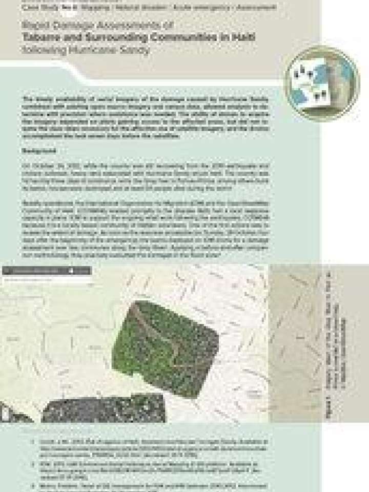
This case study highlights the role drones can play in mapping damages as well as planning protection measures to mitigate risks. The document discusses the case of post-disaster interventions after Hurricane Sandy struck Haiti in 2012.
The results from using the drone allowed precise assessment of which houses had been damaged or destroyed and analysis of how to best protect the zone from future disasters such as floods and other hydrological events. In fact, obtaining imagery at the time of the maximum flood extent enables analysts to make this kind of assessment.
Explore further
Themes
Data and information management
Recovery
Recovery planning
Risk identification and assessment
Shelter and housing
Small Island Developing States (SIDS)
Country and region
Haiti