15 January 2022 Volcanic Eruption and Tsunami. Preliminary Satellite-Based Comprehensive Damage Assessment Report: Tongatapu, Eua, and Ha'apai divisions of the Kingdom of Tonga, the 4th of February 2022
This report documents the preliminary findings of a comprehensive satellite-based damage assessment following the 15 January 2022 Hunga Tonga–Hunga Haʻapai volcanic eruption and tsunami. Prepared shortly after the event, it focuses on the most affected divisions of Tonga—Tongatapu, ʻEua, and Haʻapai—where ashfall, tsunami waves, and shockwaves caused widespread damage to settlements, infrastructure, and natural environments. The assessment was conducted to support emergency response planning and humanitarian coordination.
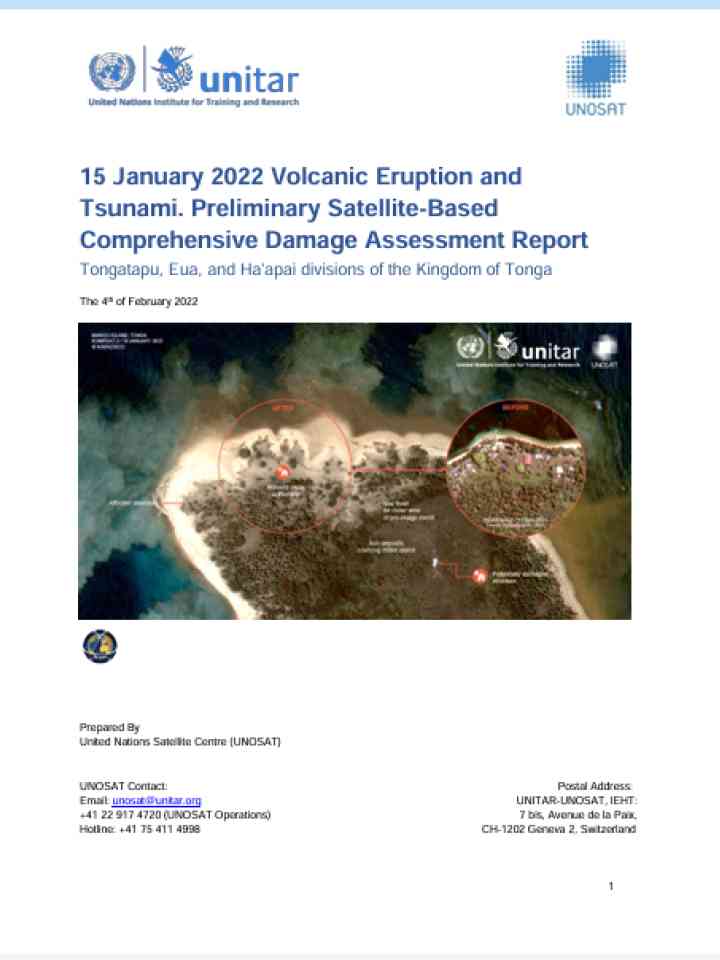
Using pre- and post-event very high-resolution satellite imagery provided through the International Charter on Space and Major Disasters, UNOSAT and partners analyzed approximately 366 km² of affected areas. The report identifies 2,935 buildings or structures with visible damage or ash deposits and 463 road and bridge obstacles that constrained access. Division-level analysis shows the highest concentration of damaged buildings in Tongatapu, while severe impacts were also recorded on smaller islands such as Mango and Nomuka in Haʻapai, where near-total destruction of structures was observed.
In addition to infrastructure damage, the report includes a preliminary vegetation impact analysis using NDVI, revealing dramatic loss of vegetation cover—up to 78% on some islands—due to ash deposition. Overall, the assessment provides a rapid, evidence-based overview of disaster impacts to inform response prioritization, logistics planning, and early recovery decision-making. It also demonstrates the critical role of satellite imagery and geospatial analysis in supporting disaster response in geographically dispersed island contexts.
Explore further