Using UAVs to Assess Disaster Risk in Fiji and Tonga: Developing the capacity and readiness of Pacific island countries
Collectively home to more than 1 million people, the Pacific island nations of Fiji and Tonga are frequently threatened by the impacts of climate change and natural hazards. In the aftermath of a disaster, these islands work hard to assess, identify and quantify risks and begin the recovery process.
Fiji and Tonga have taken many efforts to gather information about and prepare for shocks. However, consisting of many small and often remote islands, they face unique geographical challenges that impede data collection. This, in turn, hampers effective disaster prevention and response.
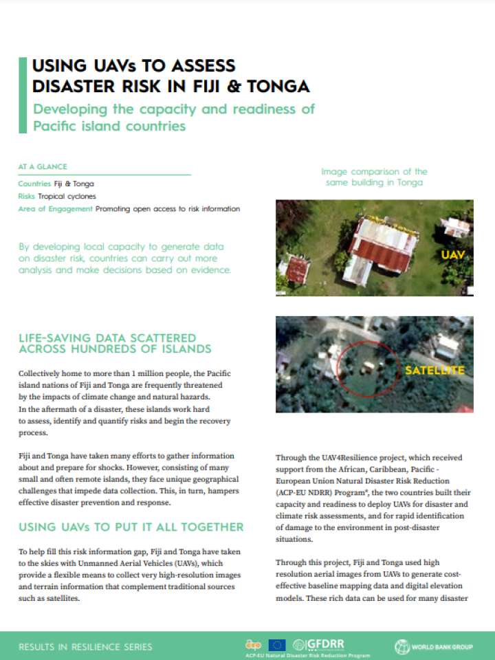
To help fill this risk information gap, Fiji and Tonga have taken to the skies with Unmanned Aerial Vehicles (UAVs), which provide a flexible means to collect very high-resolution images and terrain information that complement traditional sources such as satellites.
Through the UAV4Resilience project, which received support from the African, Caribbean, Pacific - European Union Natural Disaster Risk Reduction (ACP-EU NDRR) Program*, the two countries built their capacity and readiness to deploy UAVs for disaster and climate risk assessments, and for rapid identification of damage to the environment in post-disaster situations.
